This was one that had been on my list for a while, particularly being doable as a day trip from London, but moving to East Sussex left me with every reason to set out on my first available day off with sunshine. A very popular day hike, as well as being part of the much longer South Downs Way, it certainly lived up to all my expectations, with incredible views, fascinating geology and history, lots of stops along the way with excellent food options, and an abundance of fresh sea air. Along with the vast views of the English Channel and strikingly white cliffs, sky larks fill the air with song and either side of the track are a myriad of colours and textures, with up to 45 flowering plants filling a square metre in the chalk grasslands. All in all, a very rewarding hike!
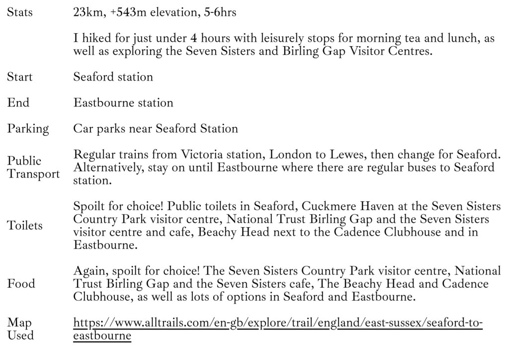
Key Details
Brief History of the Seven Sisters
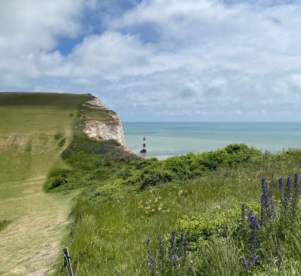
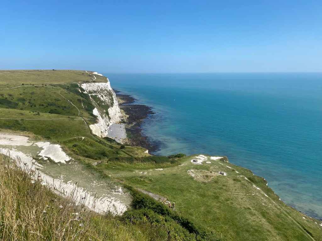
Situated in East Sussex, these brilliant white, chalk cliffs stretch between Cuckmere Haven at Exceat to Birling Gap. Despite the name, with ongoing erosion there is now an eighth sister, with 30-40cm of coastal edge estimated to crumble off the cliffs every year. While the name of the Seven Sisters comes from a cluster of seven stars known in Greek mythology as the Pleiades, the seven daughters of Atlas and Pleione, these cliffs have their own unique names. They are named, from west to east:
- Haven Brow
- Short Brow
- Rough Brow
- Brass Point
- Flagstaff Brow
- Flat Brow
- Baily’s Hill
- Went Hill

The cliffs along this stretch of coastline were formed during the Cretaceous period, 70-100 million years ago. This area was a warm, shallow sea during this time that stretched across most of north-west Europe. In this ocean was an abundance of tiny shelled marine organisms that settled on the sea bed above layers of other sedimentary deposits, and with their shells being made of pure calcium carbonate, they formed a chalk dust that gradually built up over time. Just how much time is truly staggering; it is estimated that a depth of one foot took around 30,000 years to form, so with the cliffs reaching 150m, it is hard to fathom.
During the Tertiary period, around 20 million years ago, there was the continental collision of the African and European tectonic plates that formed the Alps. This reverberated throughout the world, causing this chalk deposit to rise as a huge dome above the sea, stretching for around 200km from east to west and from the Thames Valley in the north to Pas-de-Calais in the far north of France to the south. Erosion from ice, frost and rain from then until today has carved away at this dome, along with rivers and streams. As the upper most section of the dome has disappeared with time, the chalk we see today, being the youngest layer, is left only at its edges, known as the North and South Downs, while the centre is known as the Weald and contains the oldest layers.
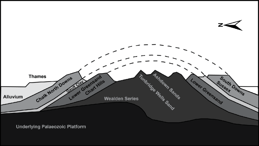

The chalk forms a giant aquifer, storing water that is fed via springs into the surrounding streams and rivers, and providing a water source for over one million people living in the area today.
There is also a wealth of human history in this area, stretching back to the Neolithic and Bronze Ages, with burial sites dotted across the landscape. The sheep that have grazed in these pastures since the arrival of these Neolithic ancestors 5,000 years ago have greatly impacted the landscape that we see today, along with clearing for agriculture and fuel. The Romans continued to use this area for agriculture, growing corn and farming animals. With the arrival of the Normans (who first landed just a little further east along this stretch of coastline at Pevensey Bay in 1066), villages grew and the number of sheep grew massively, continuing to expand through to the 19th century.
As demonstrated by the Normans, this coastline is the first point of landfall for invaders, so has had to be tightly defended over the centuries. During WWII this coastline was heavily fortified with pillboxes and tank obstacles quickly constructed. The RAF also set up a forward-relay station at Beachy Head to improve the radio communications with aircraft.
Smuggling was very common along this coastline due to the heavy import taxes on items throughout the 1700 and 1800s. Often whole villages were involved as by evading customs, goods such as tea could be sold for much lower prices, making them more accessible for ordinary people.

The Hike
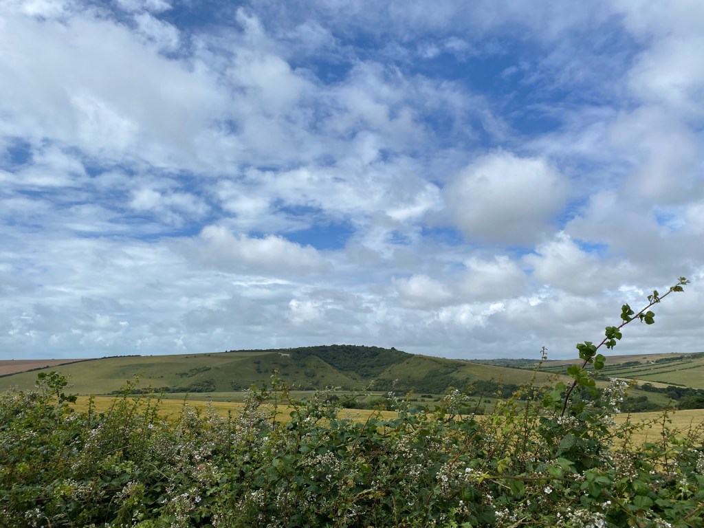
Starting from Eastbourne, I caught the extremely scenic bus to Seaford, taking all of 25 minutes. However, it is easy to reach from London, catching the Southern line to Eastbourne and changing at Lewes for Seaford, taking around 1hr30. Heading south from the station, you quickly reach the coastline and heading east, you are underway with your first of many ascents. While the hike is never technically challenging and the path is always easy underfoot and navigation straightforward, it is long and there is a decent amount of elevation gain and loss with many cliffs to conquer. You could easily cut out the first section and start at Cuckmere Haven; however, Seaford Head does provide lovely views of what is to come.
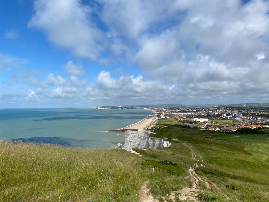
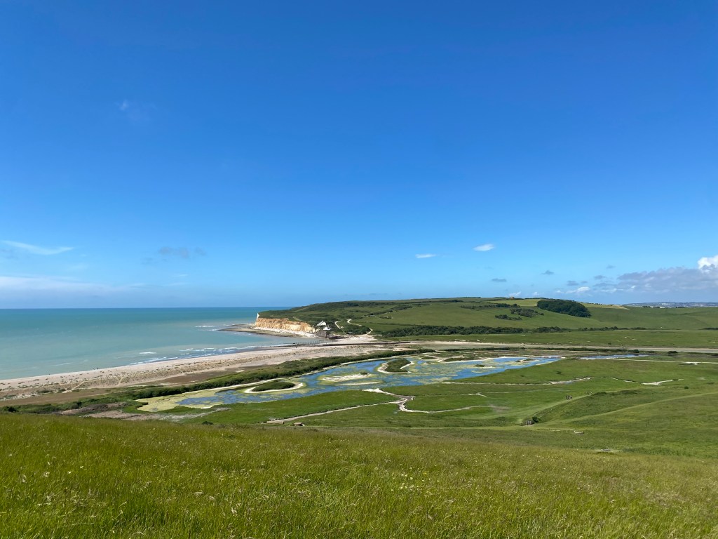
Walking around Cuckmere Haven you reach Exceat, a village that no longer really exists today after being abandoned in the 14th century, most likely due to the Black Death. Here is the Seven Sisters Country Park visitor centre, which contains lots of interesting information about the area, a well-stocked gift shop, lots of toilets, and the Grab and Go cafe, which had a great selection of locally sourced drinks, ice cream, snacks and sandwiches. Behind this is also the Saltmarsh Farmhouse and Cafe which I have since visited and it is very cosy and delicious, and the Cuckmere Inn is not far either.


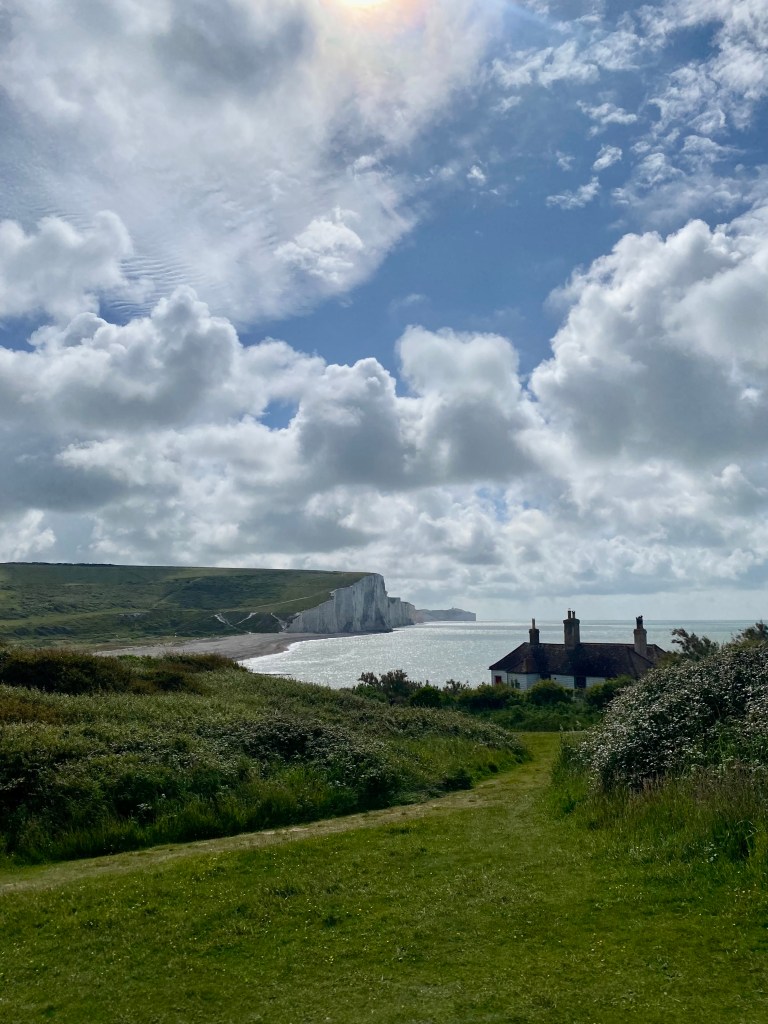
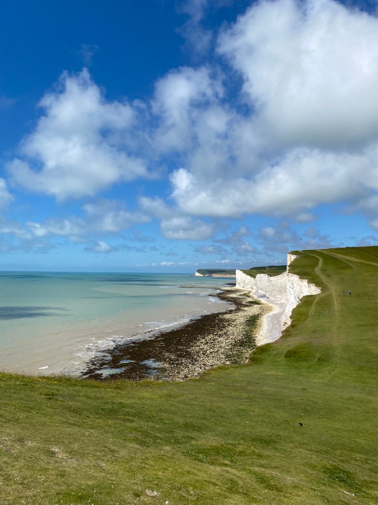
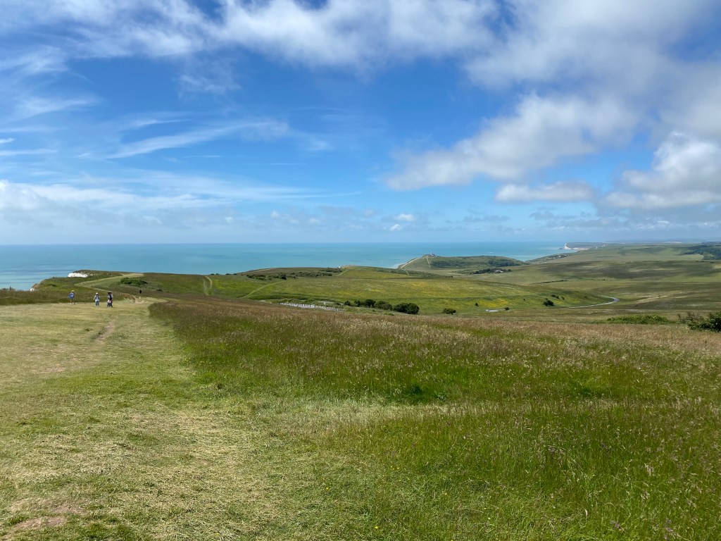
After a morning tea stop at the Grab and Go cafe, I enjoyed the flat and well-made trail along the eastern side of the Cuckmere River, before heading upwards again onto the Seven Sisters. This is a roller coaster of ups and downs, delivering stunning views in all directions and definitely firing up the legs! While on the cliffs, stay clear of the edges as they continue to erode and regularly collapse. Once up and down the last of the Sisters, Birling Gap provides access to the beach when the tide is out, as well as views back towards the Seven Sisters you have just climbed, and onwards to Belle Tout lighthouse and Beachy Head beyond.


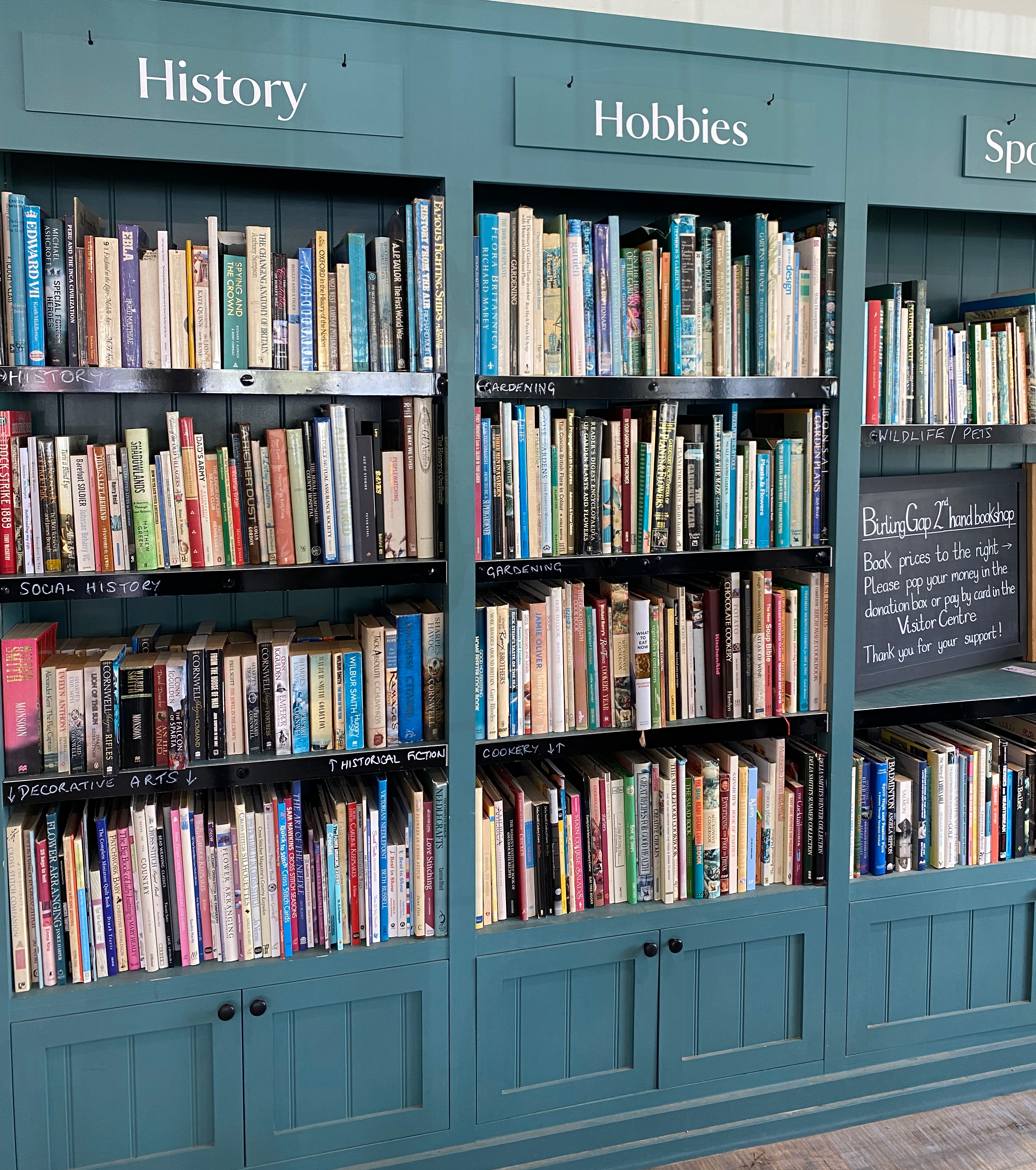
Birling Gap is owned by the National Trust and there is a large car park here bringing in many visitors, as well as a cafe, typically well-stocked gift shop as you would expect from the National Trust, a large second-hand book selection, toilets, and an informative visitor centre. Definitely no need to bring a packed lunch on this hike, as I did, with so many choices along the way!

The biggest climb was still to come, tackling the climb up to Belle Tout lighthouse, built in 1834, and then all the way up to Beachy Head at 162m above sea level. Below Beachy Head is the famous and very beautiful Beachy Head lighthouse, manned from 1902 until it was automated in 1983. The best views are as you descend from Belle Tout lighthouse, making it a great spot for lunch.


Once at the top of Beachy Head and amply rewarded by feeling on top of the world, there are more public toilets, as well as The Beachy Head and the Cadence Clubhouse cafe in the car park further on. Treating myself to ice cream to cool down and for nearly finishing the hike, it was pretty much all down hill into Eastbourne, finishing up with an easy walk along the promenade on the way to the station.


While there are lots of options for food along the way, make sure to take plenty of water as it is a long day and you are very exposed to the sun on the cliffs with very little shelter. This also means a wet weather gear and layers wouldn’t go amiss if the weather turns.
Sources
Walking the South Downs Way, by Kev Reynolds
https://www.sevensisters.org.uk/
https://www.southdowns.gov.uk/our-history/geology-of-the-south-downs/
https://www.discoveringfossils.co.uk/hastings-east-sussex/
https://www.kgg.org.uk/kentgeo.html


Leave a comment